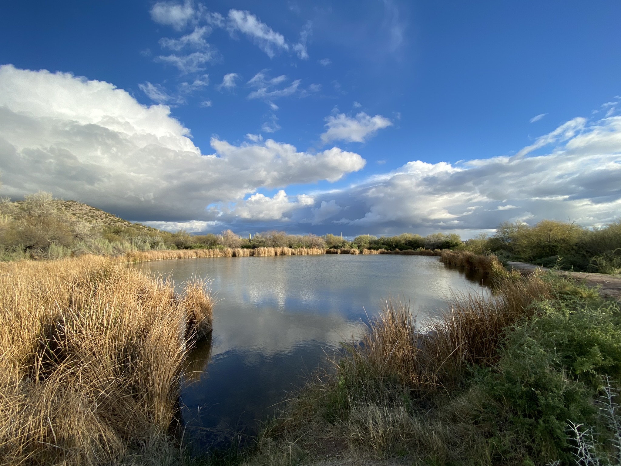
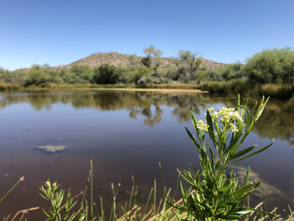
Quitobaquito Springs

“Quitobaquito” / Al’alvaipia: A Borderland Name Older Than the Border
At the far southwestern edge of what is now called Arizona, where the Sonoran Desert meets the U.S.-Mexico border, lies an oasis known to the federal government as “Quitobaquito.” For the Hia-Ced O’odham and other O’odham peoples; however, this place is called Al’alvaipia, a living sacred landscape tied to migration, ceremony, burial, water, and survival. The tension between these names reflects more than translation. It reveals a struggle over memory, authority, and the meaning of the land itself.
“Quitobaquito” is a Spanish colonial rendering of an older Indigenous place. The oasis became known to Europeans through Spanish exploration and missionary routes crossing the Sonoran Desert. In 1698, Jesuit missionary Eusebio Kino renamed the site “San Sergio,” even while acknowledging the presence of Native people already living there. Over time, the Spanish and later Anglo-American world settled on “Quitobaquito,” a name that appeared on maps, military surveys, and eventually National Park Service records.
Yet the oasis was never an empty desert stop awaiting discovery. Archaeological and oral histories show it has been continuously inhabited and visited for centuries, possibly thousands of years. The springs sat along the historic Camino del Diablo and the O’odham salt trails, sustaining travelers, ceremony, and settlement in one of the harshest desert environments in North America.
However, the names carried by the people themselves, who derive from this land, tell a different story than the colonial one. We, the Hia-Ced O’odham, historically labeled by outsiders as “Sand Papago,” identify ourselves through our relationship to the desert. The book titled Quitobaquito: A Sand Papago Cemetery records names such as Hia Tatk Ku:mdam (“Sand Root Crunchers”), and O’otkol Ha-ko’adam (“Sand Lizard Crunchers”). These names encoded ecological knowledge and movement across the dunes, tinajas (depressions), and seasonal resources of the Sonoran Desert. The Hia-Ced O’odham reflect a worldview rooted in kinship, reciprocity, and interdependence with the land and water as part of the living world rather than separate and/or ownership of it.
Al’alvaipia is not merely a watering hole. It is one of the last refuges for Hia-Ced O’odham families displaced by forced removal, violence, mining expansion, cattle interests, disease, and the international border itself. The historical record describes how the people dispersed from the Sierra Pinacate region under pressure from settlers and resource extraction during the 19th century. The oasis and cemetery at “Quitobaquito” hold the remains of at least 43 of our ancestor’s bodies connected to this final era of refuge and survival. In particular, there rests our family members of the Orozco, García, Velasco, and Ortega family lines. Some known relatives’ names include José Juan García, Luis Orozco, José Juan Orozco (identified as the last person buried there, in 1945), Wialos Velasco (“Doctor Pancho”), and Savel Orozco Velasco.
Today, the official name “Quitobaquito” often functions as a National Park landmark or ecological destination. Visitors know it for its endangered species: the pupfish, Sonoran Desert Tortoise, Pronghorn sheep, migratory birds, and desert springs. But the federal naming framework can obscure the reality that this is also a sacred O’odham burial landscape and ceremonial place. The cemetery documented in the 1982 study contains graves dating from approximately 1900 to 1945, preserving generations of Hia-Ced and related O’odham families. The graves themselves reveal an ongoing blending of Indigenous and Catholic traditions, rock-covered burials, offerings, All-Souls observances, and practices of returning to care for the dead.
The struggle over naming matters intensely now because the landscape itself remains under threat by the U.S. Customs Border Protection’s “Secondary Border Wall” installation. Border militarization has transformed this sacred oasis into contested terrain. Proposed border wall construction and enforcement infrastructure threaten not only endangered species and fragile hydrology, but also O’odham burial sites and ceremonial relationships to the land. What appears on federal maps as a remote border zone is, for the Hia-Ced O’odham, an ancestral homeland divided by an imposed international boundary.
 Organ Pipe Cactus National Monument with 100 year old saguaro cactus in the foreground. Credit: Laiken Jordahl, Center for Biological Diversity


In that sense, “Quitobaquito” and “Al’alvaipia” describe two competing understandings of place. One treats the oasis as a managed federal site inside a fortified border regime. The other understands it as part of a living Indigenous world that predates both the United States and Mexico.
The question is not simply what the place should be called. The deeper question is whose history the name is allowed to carry forward. Colonial names often freeze Indigenous lands into museum pieces, scenic destinations, or security zones. Indigenous names, by contrast, preserve relationships between people, water, land, animals, sacred ceremony, migration, memory, and self-identity.
Al’alvaipia reminds us that this oasis is not a relic of the past. It is part of an ongoing struggle for Indigenous survival, preservation, protection, and return.